


- Property Types: Land, Recreational, Patented Mining Claims
- State: Nevada
- County: Washoe County
- City: Gerlach
- Price: $390,000
- Total Acreage: 148.67
- Property ID: Leadville mines
- Property Address: State Route 34, Gerlach, NV
- APN: various
- GPS: 41.09869595984, -119.40272115356
- Roads: gravelled / dirt
- Power: No
- Seller Fees: 135
General Information:
Owner financing available
Owner financing available
Leadville mines
Washoe County Nevada
Land * Real Estate
LEADVILLE MINES 8 Patented Mining Claims Totally surrounded by Government lands
Parcel Name - Mineral Suryey# - Apn# - Size
- Ajax #1 - MS#3877 - Apn#066-120-07 - 20.66 +/- acres
- Ajax #2 - MS#3906 - Apn#066-120-06 - 17.38 +/- acres
- Ajax #1 - MS#3906 - Apn#066-120-05 - 12.64 +/- acres
- Independence #1 - MS#3676 - Apn#066-120-11 - 16.73+/- acres
- Independence #3 - MS#3905 - Apn#066-120-04 - 19.28 +/- acres
- Independence #4 - MS#3877 - Apn#066-120-08 - 20.66+/- acres
- Tohoqua - MS#3178 - Apn#066-120-09 - 20.66+/- acres
- Tohoqua #2 - MS#3178 - Apn#066-120-10 - 20.66+/- acres
- Total combined size is 148.67 +/- acres. - All located in the Leadville Mining District
- STATE: Nevada
- COUNTY: Washoe
- GENERAL LOCATION: about 34 miles North of Gerlach Nevada. About 103 miles North of IH 80 and Wadsworth
- DRIVING DIRECTIONS: From IH 80 take the Wadsworth Exit North to Wadsworth, Empire, Gerlach and beyond. Go North on NV 34
- GPS (approx. ): State route 34 Turnoff point: 41.09889 , -119.38607 from the turn off point the 1st parcel (Independence #1) starts between 6/10th & 7/10th of a mile
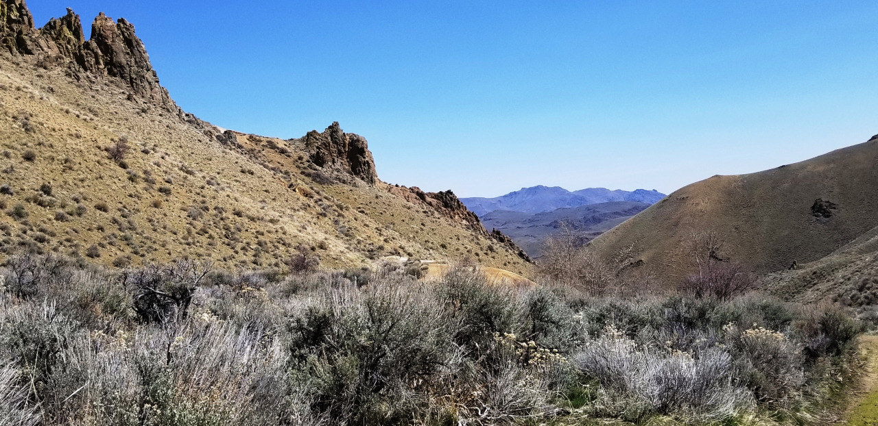
- GENERAL ELEVATION: 6050-6850 ft
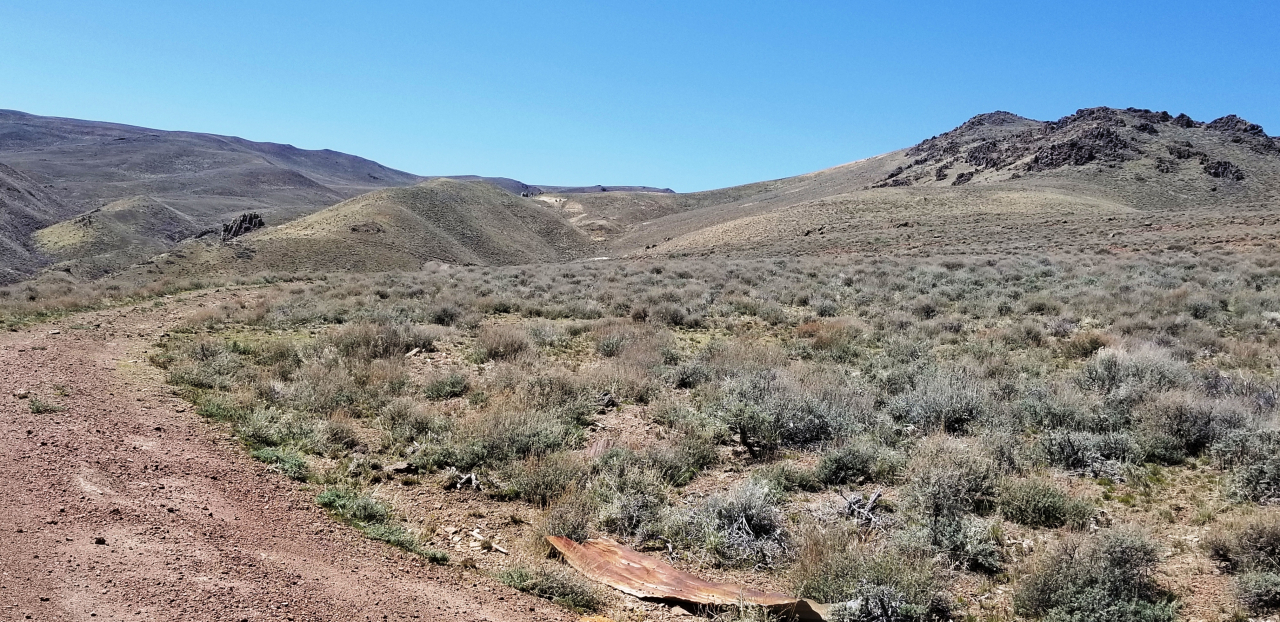
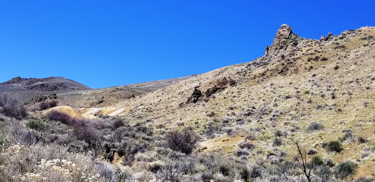
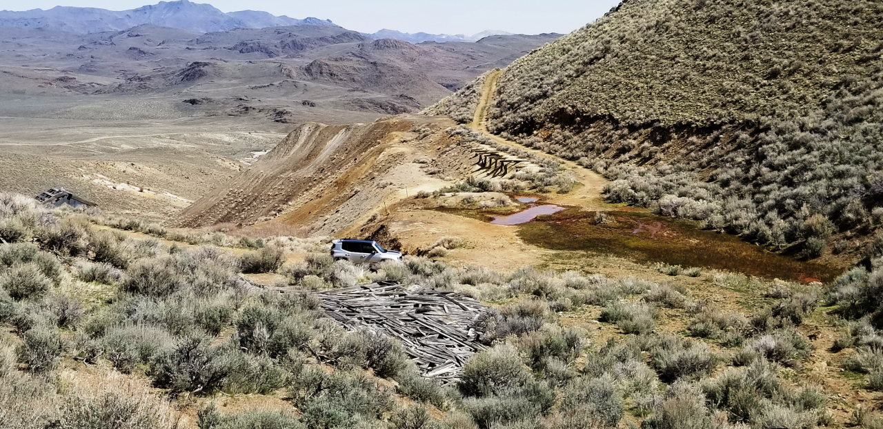
- GENERAL INFORMATION: Totally surrounded by BLM/US Government lands. Everything on the MAP that is not outlined is Government lands. The Old Mine Tunnel is on Tohoqua #2 MS#3178 and is flooded and collapsed.
- TYPE OF TERRAIN: Hilly - mountainous
- ZONING: check with county for your intended usage.
- POWER: NO
- PHONE: NO
- WATER: no. would need to install well or holding tank.
- SEWER: No. Only needed when/if you build.
- ROADS: unimproved dirt after turnoff.
- PROPERTY TAX: $51-$88 per parcel per year
- CLOSING/DOC. FEES: $135
- TIME LIMIT TO BUILD: none
- ASSOCIATION DUES: none
- TITLE INFORMATION: Free and clear
- MAPS LINK
- Owner financing available.
- No Qualifying. No Credit Checks.
- Leadville WIKIPEIDA INFO LINK * UNR INFO LINK * WESTERN MINING HISTORY LINK * Tohoqua Wikipedia Info link * Black Rock Explorers Info link
- Gps/lats/longs coordinates are provided as a tool to assist the Buyer.
- Use the maps to confirm.
- BUYER TO VERIFY listings' GPS coordinates
- FINANCING INFO and PURCHASE INFO
- 1881.com main LAND PAGE
YOU TUBE: https://youtube.com/shorts/Nkc2sAwsAOY
