


- Property Types: Land, Recreational
- State: Alaska
- County: Kenai Peninsula Borough
- City: Soldotna
- Price: $12,500
- Total Acreage: 0.55
- Property ID: caribou island (eopp)
- Property Address: Gene Smart REM NW, Soldotna, AK
- APN: 13505145
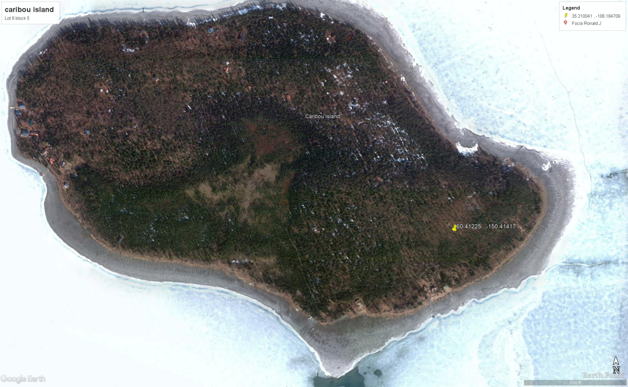
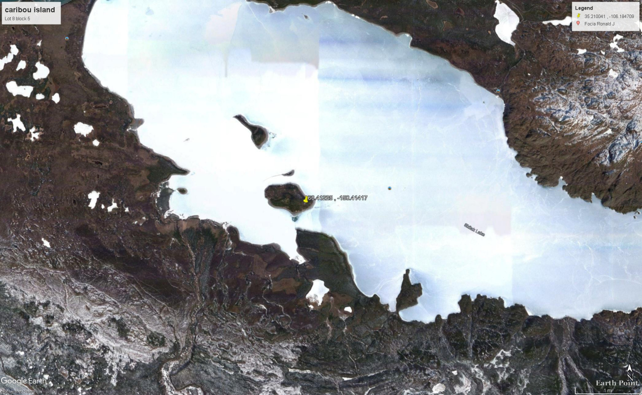
- GPS: 60.41225, -150.4147
- Subdivision: Caribou Island amended
- Block: 5
- Lot: 8
- CCRs: none
- Association Fees: no
- Roads: platted road. ATV trail
- Power: no
- Seller Fees: 90
Owner financing available
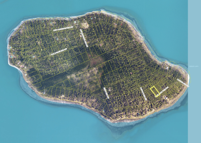
CARIBOU ISLAND
L8 Block 5 Caribou Island Amended
Apn#: 13505145
Legal Description: Caribou Island sub. amended Lot 8, Block 5, according to the Official Plat thereof filed under Plat # S-37, in the records of the Seward Recording District, third Judicial district, State of Alaska
Location: Interior parcel on Caribou Island, located on Skilak Lake.
Acreage: 0.55 Acres
Amenities: Popular recreation area on Caribou Island and Skilak Lake!
Borough: Kenai Peninsula Borough
Zoning: Unknown - BTV
Access: Remote. Located adjacent platted access road Gene Smart REM NW.
Utilities: none
GPS (approx): 60.41225 , -150.4147
Topography: Appears to be relatively level with a decline towards the lakeshore, with a mixed stand of spruce and birch from satellite imagery.
Elevation: shoreline sits at approx 195'. This lot ranges 250'-260'
Access: via Gene Smart REM NW
https://alaska.guide/Island/Caribou-Island/1412732
Caribou Island is an island in Alaska. The nearest community to Caribou Island is Soldotna. Explore the tabs above and the information below to learn more about Caribou Island.
Caribou Island is located on Kenai Peninsula, in Tustumena lake, 24 miles south-southeast of Kenai, Cook Inlet Low. 3 miles long
Skilak Lake is a large lake on the Kenai Peninsula, Alaska. The lake is part of the Kenai River system but also contains glacial runoff, being fed by meltwater from Skilak Glacier. The water is exceptionally clear with a mostly rocky bottom, relatively free of aquatic vegetation. It is within the Kenai National Wildlife Refuge, and can be accessed by Skilak Lake Loop Road via the Sterling Highway. Maximum depth is 528 feet (161 m), it is 15 miles (24 km) long and up to 4 miles (6.4 km) wide in places.
