
- Property Types: Land, Residential, Recreational
- State: Utah
- County: Box Elder County
- City: Wendover
- Price: $8,500
- Total Acreage: 10
- Property ID: box elder 10 (npnp)
- Property Address: Wendover, UT
- APN: R0005364
- GPS: 41.201867163886, -113.88444565568
- CCRs: none
- Roads: unimproved dirt
- Power: No
- Taxes: $65
- Seller Fees: 130
Owner financing available
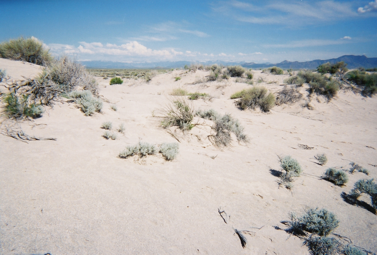
Western Utah Desert * Borders BLM to the North
Rolling Sand
SIZE: 10+/- acres
APN#: R0005364
LEGAL DESCRIPTION: N/2 OF N/2 OF NW/4 OF NW/4 OF SEC 35 TWP 6N R 18W SLM CONT 10.00 ACS
STATE: Utah
COUNTY: Box Elder
GENERAL LOCATION: about 1.75 miles East of Pilot Mountain Road. NE of Wendover. About 8.25 miles East of the Nevada State Line
GPS (approx.): NW@rd: 41.20203 , -113.88484 ; SW: 41.20119 , -113.88480 ; NE: 41.20207 , -113.88011 ; SE: 41.20117 , -113.88010
GENERAL INFORMATION: Remote! Lots of Rolling sand hills Camp, RV, Mobiles, Modulars allowed
GENERAL ELEVATION: 4280'-4300'
TYPE OF TERRAIN: Rolling sand
POWER: No
PHONE: no. some cell phones work
WATER: no must install well or holding tank if you build
SEWER: no. must install if you build
ROADS: unimproved dirt
PROPERTY TAX: $65
CLOSING/DOC. FEES: $130
TIME LIMIT TO BUILD: none
ASSOCIATION DUES: none
Property info will be updated if we acquire more info
Go to 1881.com Area land page
